
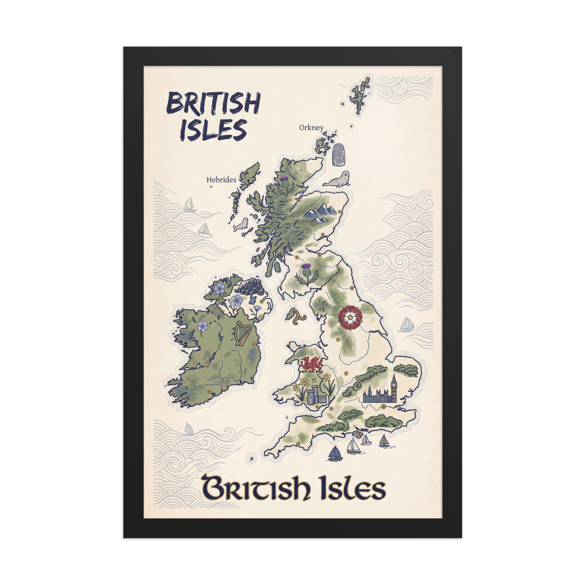

Stylized Map of the British Isles Unique Mega Print
Discover geographical beauty and cultural charm with our Stylized Map of the British Isles Unique Mega Print. This stunning oversized artwork features an artistically rendered map of the British Isles—England, Scotland, Wales, Northern Ireland, and the Republic of Ireland—transformed through contemporary design into a captivating statement piece that celebrates regional character, geographical elegance, and the rich tapestry of history and landscape across these iconic islands.
This exceptional mega print reimagines traditional cartography as fine art through stylized contemporary design that balances geographical accuracy with artistic interpretation. Moving beyond standard maps, this artwork employs creative color palettes, decorative elements, illustrated landmarks, regional symbols, vintage-inspired aesthetics, modern minimalist approaches, or artistic treatments that transform functional geography into wall-worthy art with personality and visual sophistication.
The British Isles offer rich geographical diversity and visual interest—the rugged Scottish Highlands, rolling English countryside, dramatic Welsh mountains, Irish green landscapes, intricate coastlines with countless bays and peninsulas, major cities from London to Edinburgh to Dublin, historic regions, cultural boundaries, and the distinctive shapes of Great Britain and Ireland that are instantly recognizable and beautifully complex for artistic rendering.
The stylized approach brings artistic sophistication to geographical subject matter. This might feature vintage map aesthetics with aged paper textures and classic typography, modern minimalist designs with clean lines and contemporary color blocking, illustrated maps adorned with regional icons and landmarks, watercolor or painterly treatments, decorative borders and compass roses, hand-lettered place names, regional color coding, topographical artistic interpretation, or graphic design approaches that emphasize shape, pattern, and visual rhythm over pure cartographic function.
Regional elements add character and storytelling depth—illustrated landmarks like Big Ben, Edinburgh Castle, Stonehenge, Giant's Causeway, or the Cliffs of Moher; cultural symbols including thistles for Scotland, roses for England, daffodils for Wales, shamrocks for Ireland; regional animals, historical references, famous geographical features, major cities marked with decorative elements, bodies of water labeled in elegant typography, or subtle patterns and textures that differentiate regions while maintaining cohesive artistic vision.
The color palette shapes the artwork's mood and style—vintage maps might embrace sepia tones, aged parchment backgrounds, muted historical pigments, and classic cartographic colors; modern interpretations could feature bold contemporary palettes, unexpected color combinations, monochromatic sophistication, pastel softness, jewel tones, or region-specific color coding that's both functional and beautiful. Coastal waters, land masses, and regional boundaries offer opportunities for artistic color play that enhances both legibility and aesthetic appeal.
Available in impressive mega print sizes that command attention and create instant focal points, this artwork is designed for spaces that appreciate geographical beauty and cultural connection. Perfect for large walls above sofas, desks, dining tables, or in living rooms, home offices, studies, entryways, hallways, and travel-inspired interiors, the generous proportions allow appreciation of geographical details, regional features, decorative elements, and typography while creating significant visual impact that transforms the map from reference to fine art.
Perfect for British expats and anglophiles, travel enthusiasts, history lovers, geography buffs, heritage-conscious homeowners, and anyone with connections to the British Isles through ancestry, travel, or cultural appreciation, this mega print brings meaningful beauty and sophisticated style into your home. Ideal for modern interiors, traditional studies, eclectic spaces, coastal homes, libraries, offices, or any room wanting artwork that combines aesthetic appeal with geographical interest and personal significance.
The stylized map format offers remarkable versatility—educational and decorative, personal and universal, sophisticated enough for adult spaces yet engaging for family areas, working beautifully in both traditional and contemporary interiors. The British Isles' distinctive shapes and cultural richness provide inherently interesting subject matter that rewards viewing and sparks conversation about travel, heritage, history, and regional character.
A white border provides an unprinted margin around your image, creating a clean, framed appearance that mimics professional matting found in galleries and museums. This added space helps the eye settle on the art piece, enhances contrast with the surrounding wall or frame, and gives the piece a more polished, intentional presentation.
Including a border will reduce the visible area of the printed image slightly, since some of the art sits behind the unprinted edge, but the overall paper or sheet size remains the same. That means you retain standard dimensions for framing or display while achieving a restrained, elegant look. For anyone aiming for a minimalist, museum-quality aesthetic—whether for home décor, professional portfolios, or gallery displays—a white border is a simple, effective way to elevate the presentation.


